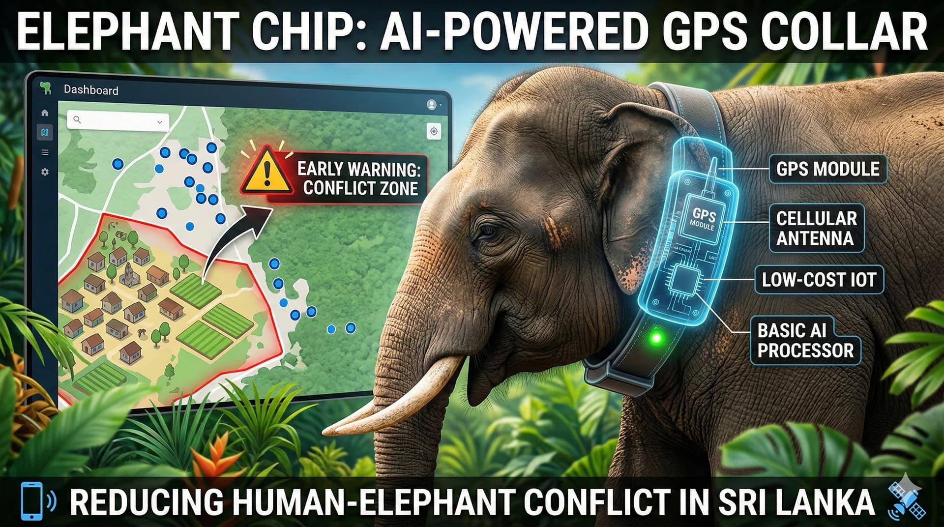
An Arduino-based, low-cost GPS collar system designed to track wild elephants in Sri Lanka to mitigate human-elephant conflict through geofencing and immobility alerts.
The project context, the problem being addressed, the delivery approach, and the intended outcome.
Elephant GPS Tracking Belt is a wildlife-tech concept focused on building an affordable, field-ready tracking collar system for elephants in high-conflict regions. It combines hardware design, geofencing logic, SMS-based alerts, and ranger-friendly monitoring workflows aimed at safer and earlier intervention.
The project was framed around Sri Lanka’s human-elephant conflict challenges and the need for scalable, open-technology alternatives to premium conservation hardware.
Challenge
Commercial wildlife tracking systems are often too costly for broad deployment, leaving authorities with limited real-time movement visibility in areas where elephant movement can threaten lives and livelihoods.
Approach
Conceptualized a low-cost GPS tracking belt with geofencing, immobility alerts, and ranger-friendly monitoring workflows for proactive intervention.
Intended impact
Safer monitoring, faster response, and measurable reduction in conflict incidents in targeted pilot regions.
What it is
A low-cost collar and tracking dashboard system.
Why it matters
It supports proactive, non-lethal wildlife response in conflict-prone areas.
Who it serves
Wildlife authorities and communities living near elephant corridors.
Objectives & success
Primary goal
Deploy affordable, functioning elephant collars in a high-conflict pilot zone.
Supporting goals
Generate SMS-based geofence alerts and validate a low-bandwidth ranger workflow.
Success criteria
Hardware bill of materials below target cost, successful coordinate transmission, and usable alert behavior in field scenarios.
Low-bandwidth software view optimized for location updates and actionable alerts.
Vidula Wickramasinghe
Web
Not Started
Refine field workflows.
Deployment Framework
Operational structure covering pilot goals, field assumptions, and authority coordination.
Vidula Wickramasinghe
.PDF
Not Started
Prepare pilot documentation.
Technical & Delivery Strategy
Implementation and rollout notes for the current project approach.
Rugged IoT & Power Efficiency
•Keep the Arduino core in deep sleep most of the time and wake it only for satellite pings or immobility alerts.
•Store geofence boundaries locally on the collar so it only transmits SMS alerts when the elephant crosses into sensitive zones.
•Encapsulate electronics in marine-grade waterproofing and mount them to heavy-duty, chafe-resistant belting.
Securing Institutional Buy-In
•Use the initial 50-collar pilot to prove the target hardware cost and show measurable conflict-reduction potential.
•Design the ranger-facing software for low-bandwidth mobile use with actionable alerts rather than overly complex dashboards.
•Build trust with local farming communities so alerts can trigger coordinated non-lethal response with rangers.
Risks & Blockers
Open issues, risk posture, dependencies, and assumptions for the current project state.
Hardware failure caused by elephant behavior and harsh field conditions.
Likelihood: Medium • Owner: Vidula Wickramasinghe
Mitigation: Use heavy-duty belting, waterproofing, and stronger casing strategies.
High Risk
Project Gallery
Verified visuals and walkthrough media associated with this project.
Cover visual
Primary concept visual for the elephant tracking and alert system.
1 / 5
Documents & Resources
Quick access to project references, links, and support contacts.
Project brochure
Interactive project brief
Repository or product link
Available on request
Request
Contact for access
Available on request
Request
Have questions or need access?
Use this full project view as a case-study reference and reach out directly if you need credentials, supporting documentation, or a walkthrough of the delivery details.